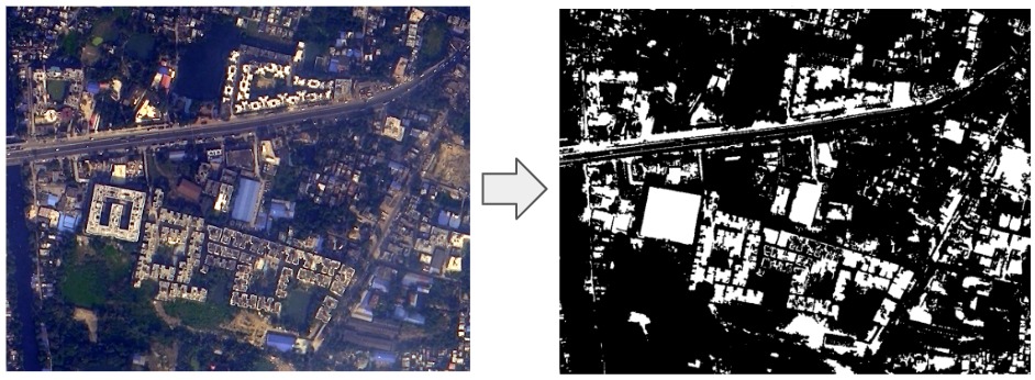
Building Footprint

Building footprint extraction is a critical component of geospatial intelligence that involves identifying and delineating the outlines or footprints of structures, such as buildings, within a geographic area. This process is essential for various applications:
- Urban Planning: Building footprints is essential for urban planners to assess land use, zoning, and density, aiding in the design of sustainable and efficient urban environments.
- Infrastructure Development: For utilities, transportation networks, and municipal services planning accurate building footprint data is crucial for locating infrastructure components and ensuring efficient service delivery.
- Disaster Response: In the aftermath of disasters like earthquakes or floods, building footprint data are used to assess damage, prioritize search and rescue efforts, and plan for reconstruction.
- Environmental Analysis: Building footprint data contribute to environmental studies by assessing urban heat island effects, energy consumption, and green space preservation.
Use Case:
- Urban Planning: Geospatial Intelligence in Urban Planning.
- Land Use Classification: Identify land types for sustainable city development.
- Transportation Network Analysis: Optimize city traffic and infrastructure.
- Building Density: Plan housing and urban expansion.
- Environmental Impact Assessment: Assess the eco-friendliness of new developments.
- Change Detection: Monitor land use changes over time.
- Population Density Estimation: Plan services for growing communities.
- Utility Planning: Manage essential city utilities efficiently.
- Visualization and Simulation: 3D models aid decision-making.
- Informed Urban Growth: Leverage geospatial data for sustainable cities.
